Long Range Transportation Plan (LRTP) for the Stateline Area
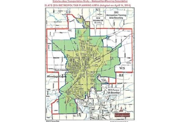
SLATS is working on a 5-year update to the Long Range Transportation Plan (LRTP) for the Stateline area. The LRTP is for all modes of transportation in the Stateline area including automobile, freight, rail, walking, biking and transit. All transportation projects eligible for federal funding for each community (see map*) between now and 2045 must be included the LRTP, which is why public input is so important. You have the opportunity to shape how millions of federal transportation dollars will be invested in the Stateline Area over the next 20+ years.
We invite you to enter our virtual meeting room by going to SLATS2045LRTP.com The virtual room, which also functions as an on-going open house, includes:
- A survey (in English and Spanish) regarding existing transportation conditions (you can also access the survey directly using this link: https://www.surveymonkey.com/r/TMX3F82)
- An interactive map where you can identify transportation related issues by dropping a pin on a map and leaving comments
- A project overview summarizing the key elements of the LRTP
- A project schedule
- Contact information to reach the project team
*The LRTP includes the area outlined in red, spanning the Stateline, as well as regional connections to areas outside of SLATS (e.g. the Rockford and Janesville regions).
The Stateline Area Transportation Study (SLATS) established in 1974, is the federally designated Metropolitan Planning Organization (MPO) for the Beloit urbanized area (as defined by the US Census Bureau). SLATS spans the state line and includes portions of Wisconsin and Illinois. The purpose of an MPO is to conduct a federally mandated, 3-C (continuing, cooperative and comprehensive) intergovernmental transportation planning process for all urbanized areas over 50,000 in population. The SLATS MPO Metropolitan Planning Area (MPA) comprises more than 100 square miles and has a total population of nearly 69,000.


